- Clothing man
- Clothing woman
- Footwear
- Canyoning
- Rock Climbing
- Caving
- Working Vertical
- Offers


 View larger

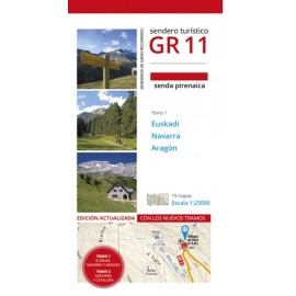
GR 11: Senda Pirenaica Tomo 1 Prames
GR11 Prames
New
GR 11: SENDA PIRENAICA PRAMES (Volume 1)
This guide collects 19 maps with a detailed description of the GR 11 trail with explanations of all the stages and 1: 25000 scale maps.
This product is no longer in stock
- Shipping cost for the total purchase:
- Recoger en tienda : 0,00 €
More info
GR 11: SENDA PIRENAICA PRAMES (Volume 1)
This guide contains 19 GR 11 maps with explanations of all the stages and 1: 25000 scale maps. Walking trails in the Pyrenees from Cape Higer facing the Atlantic, to Cap de Creus, facing the Mediterranean, through the communities of the Basque Country, Navarra, Aragon and Catalonia, and the Principality of Andorra. They are more than 1,000 km for the most rugged Hispanic mountain, for the main landscapes and ecosystems of the Pyrenean mountain range, crossing the Ordesa and Monte Perdido national parks, and Aigüestortes i Estany de Sant Maurici, several natural parks and, in Aragonese lands, the Natural Monuments of the Pyrenean Glaciers.
DATA SHEET:
Authors: Fernando Lampre Vitaller.
Publisher: Prames.
Place of edition: Zaragoza.
Binding: Rustic.
Dimensions: 12.5 x 22.5 cm.
Page No.: 155.
Language: Spanish.
Volume 1 (Euskadi, Navarra and Aragón).
Reviews
No customer comments for the moment.